|
Page 1 of 3 In March of this year, news sites on the internet created controversy based on a writer who claimed to know that Simone Moro was aware he did not climb the highest of the three Beka Brakai Chhok peaks.
This is certainly untrue and will be explained here in detail. The “case” of Beka Brakai Chhok (BBC) is truly one of the most confusing subjects in the history of High Asian research. Simone Moro achieved a fine, historical first ascent, a relatively rare feat in modern times. He and his companion Hervé Barmasse well deserved the “Dalla Longa Award”: BBC South is without question the most beautiful and the most challenging of the three BBC peaks.
In 2006, after private correspondence, it was realized that BBC Central is the highest of the three summits.
If you want to know the difference between the “big” world of passionate climbing, and the “small” world of private passionate research, then you need look no further than the story of BBC. This is a saga about peak identification and listing: it is about comparing maps and checking photos from all directions, mainly panoramas produced by expeditions that achieved first ascents. People involved in this confusing story are not to blame, particularly not the recent first ascensionists.
The Beka Brakai Chhok Puzzle:
It began nearly 75 years ago, when the name first appeared on Reginald Schomberg's Batura Sketch Map, published in the Alpine Journal (Vol 249, November 1934). It was then spelled "Beka Brakai Chok".
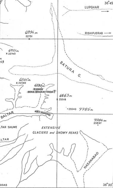
The peak was surveyed back in 1913 at 22409 feet (6830 m). It appeared unnamed on the Morris map of 1927, and in 1938 was listed as Peak 48 in Kenneth Mason’s “Karakoram Nomenclature”.
The coordinates corresponded with BBC North East (NE): BBC Central (C) and South (S) were completely unknown.
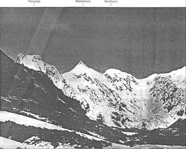
In 1976 a photo was taken by Dr. Alexander Schlee, leader of the German expedition that succeeded on the first ascent of Batura Sar I. On this photo he named BBC NE the "Breithorn" and BBC S the "Matterhorn".
From this perspective BBC C lies behind BBC S and is barely visible: it also appears lower. Here lies the basis for all subsequent confusion.
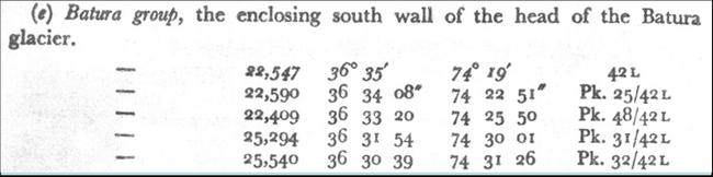
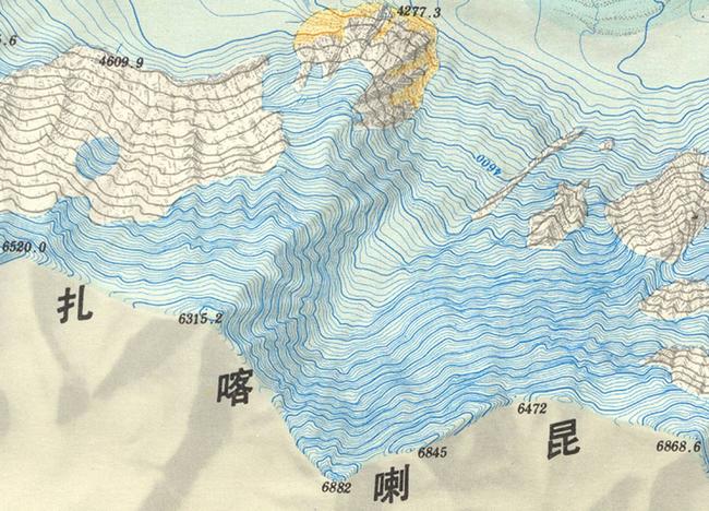
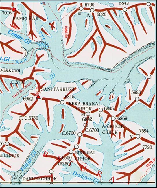
In 1978 the Chinese published a 1:60K map with contours. It contained results from a precise survey begun in 1974, but only from north of the Batura Wall. On this map BBC NE is 6845m and BBC C 6882m.
BBC S was not visible from the northern survey stations, so there was still no quoted altitude or name for the "Hunza-Matterhorn".
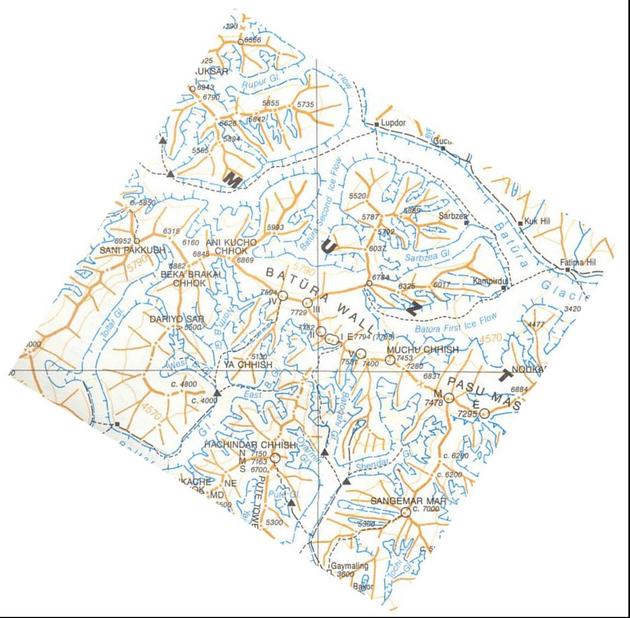
In 1990 the Swiss Foundation for Alpine Research published a map of the Karakoram in two sheets. This was the result of excellent cooperation between four people, in a time where there was no internet and telephone rates were expensive. The four were the Swedish Himalayan chronicler Anders Bolinder, the Polish cartographer and Karakoram specialist Jerzy Wala, the Polish researcher Zbigniew Kowalewski and the German researcher Eberhard Jurgalski (the author of this report).
Wala adopted the well-surveyed altitudes from the Chinese map; BBC NE 6845 and BBC C 6882. The name discovered by Schomberg was also adopted but switched to designate the higher (Central) peak. This was the first 'main-peak name jump'. A second 'h' was added to Chhok to bring it in line with other peaks in the area, eg Aikache Chhok.
BBC S was still unknown, not marked on this sketch map, and for a long period of time confused with BBC C.
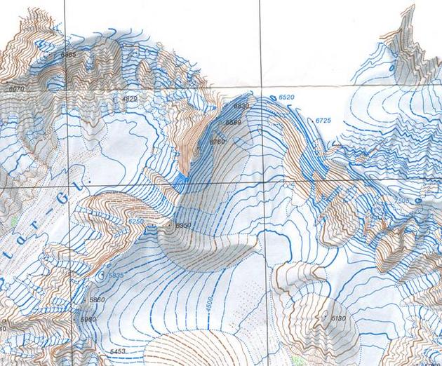
In 1995 the DAV published a 1:100K map, with data from the Austro-German expeditions in 1954 and 1959. The Austro-Germans obviously did not have the opportunity to survey the BBC summits. They used the old 1913 Mason figures for most peaks on the Batura wall and also 6830m for BBC NE. It appears the DAV only had the Schlee photo from 1976, and calculated BBC S to be 70m lower than BBC NE, giving a result of 6760m. As mentioned above, on this photo BBC C cannot be recognized as separate peak, so the DAV erroneously increased height contours to c6700m on the map.
In 2001 the Japanese “Mountaineering Maps of Karakorum and Hindu-kush”, a fine study including sketch maps, were published. Here, south of BBC C, the Japanese erroneously marked two peaks, both only 6700 m. So, are there four BBC Peaks and two of them that low? No!
<< Start < Prev 1 2 3 Next > End >>
|